The Flanders Soil Databank (Databank Ondergrond Vlaanderen, DOV) is to make its tablet-PC based soil erosion monitoring map tool available as open source. DOV staff use this software in the field to update geographic maps that are displayed on these mobile devices.
The map tool is developed by Roel Huybrechts, a GIS specialist at Realdolmen, an IT service provider contracted by the DOV. When the tool would be available, the GIS specialist was unable to say. The decision has been made, but we have not set the date yet.
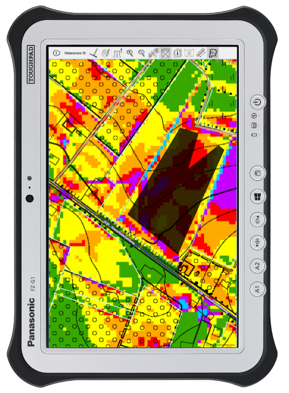
Up until last year, these checks were done on paper prints of the maps, with the computer maps being updated later. Now the field staff use tablet PCs, and the maps are updated automatically. The manual process works fine if there are just a few complaints. It does not work when there are 2,000 objections
, says Huybrechts.
The new method, now used by five soil erosion specialists, is based on well-known open source Geographic Information Systems (GIS) tools, including the data viewing tool QGis and the Geospatial Data Abstraction Library. QGis is the perfect platform for building GIS applications
, Huybrechts said at the FOSS4G 2016 conference in Bonn last August. It’s open source, it is supported by a great community and it comes with a collection of tools and toolkits.
The tablet application that Huybrechts developed combines OpenStreetMap with several of the DOV’s maps, such as the soil map, last year’s soil erosion map, and the water runoff map. Huybrechts tweaked the GQIS map viewer to make it easy to use with just one finger. Menus were removed and icons enlarged, and the map was oriented to make room for a keyboard, making it easy for staff to make annotations in the field.
More information:
Databank Ondergrond Vlaanderen
Presentation by Roel Huybrechts (PDF)
Foss4G 2016 conference website
Presentation by Roel Huybrechts (webm)