Check out the recording and supporting slides for the ELISE webinar - Geospatial Data and Artificial Intelligence – a deep dive into GeoAI?
If you are interested in knowing more about ELISE Webinars you can find further information here.
Structure of the presentation
- Introduction – Setting the scene & key terms
- GeoAI - Origins, present & future trends – research areas and applications
- Enabling GeoAI - Converging political & technical environments
- GeoAI applied - Demonstrating mounting relevance in key public policy areas
- Interoperability efforts and challenges
- Key take-away messages and conclusions
Recording
Summary of the webinar
The webinar on Geospatial Data and Artificial Intelligence – a deep dive into GeoAI, explored several key advancements within AI technologies and aimed to demonstrate their current application and relevance in central public policy areas.
The webinar was structured as described below to give the audience a complete understanding of the context, origin, political and technical environment, and examples of real cases and interoperability challenges.
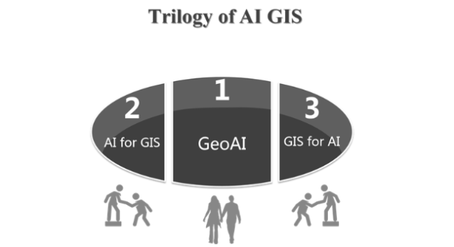
1. GeoAI was introduced together with some key terms and definitions. According to Gartner, GeoAI, is the use of artificial intelligence methods, including machine learning and deep learning, to produce knowledge through the analysis of spatial data and imagery[1]. The increased availability of geospatial data, the advancements of AI, and the availability of massive computing power has resulted in the mounting relevance and potential of GeoAI. The concept was placed in the broader framework of AI-intra relationships as a sub-discipline of AI that uses machine learning to extract knowledge from spatial data.[2]
2. The origin and future trends of the concept were presented. GeoAI is a concept that dates back to the mid-nineties (Black, 1995) and is an established field in itself. It is expected to continue to help create more powerful and intelligent applications.
3. The technical and political environment was presented together with the key enablers and advancements in the field of GeoAI. The policy context focussed on the EU policy and drivers of interoperability and standards. The technical context provided insights into three key areas for the uptake of GeoAI; Big data and analytics, massive computing power; and human-systems integration.
4. Interactive presentation of real examples of GeoAI. The audience voted for their top three choices of seven case studies proposed, selecting the following case studies:
- GeoAI to close the map gap: Facebook and OSM's initiative "Map with AI" and its interface RapiD
- GeoAI in health and environment: the German IT company Breeze Technologies tackles pollution with AI-enabled tracking
- GeoAI in public health and environment: the PILSE project and its mHealth application Pulsair
Following this, interoperability efforts and challenges were presented. This included the state of play on standards and interoperability in Europe, such as OGC GeoAI DWG and ISO, and the key elements to tackle to move forward on semantic interoperability.
The webinar concluded by emphasising the following key messages:
- Increased availability of geospatial data, the advancement of AI and the availability of massive computing power has created momentum for the digital exploitation of geospatial data.
- AI technology presents new opportunities to integrate, exploit, and use geospatial data for geospatially-informed insights and predictions.
- Through the examples given, we see that the GeoAI techniques employed can build public sector capabilities in moving from reactive to predictive and thereby produce new and innovative solutions.
- While GeoAI can be a tool for increased growth, efficiency, security and more, challenges related to regulation, interoperability and standards remain.
The elements central to the ELISE action (location interoperability, digital transformation and innovation) were addressed throughout the webinar. For example, location intelligence, a key aspect of location interoperability, plays an essential role in GeoAI. This is because GeoAI combines artificial intelligence and geospatial information to create more intelligent applications and systems. As demonstrated in the examples given in the presentation, such solutions can be employed in a wide array of policy areas and contribute to the move towards Digital Government. Concerning location interoperability, Estonia's AI strategy (Kratt AI [3]) employs GeoAI solutions for agricultural monitoring and aims at improving the interoperability of such government solutions.
Geospatial data could be leveraged by coupling it with exponential AI technologies to achieve more efficient solutions regarding digital transformation. There are some fundamental challenges to realizing this transformation (i.e. interoperability, standards, human trust and regulation). However, there are also opportunities such as market growth, the contribution of such digital technologies in accelerating the European Circular economy and its potential role in addressing both local and global challenges.
Last, innovative approaches were promoted by demonstrating real application areas where companies and governments have used new solutions and technologies to produce deeper, new and more accurate findings. For example, the case study of Facebook Artificial Intelligence and OpenStreetMap's Map with AI [4] has allowed for mapping 300 000 miles of previously unmapped roads in Thailand in 18 months. These initiatives demonstrate how innovation can create benefits.
[1] https://joinup.ec.europa.eu/collection/elise-european-location-interoperability-solutions-e-government/glossary/term/geoai
[2] UNGGIM, Future Trends Report (2020).
[3] More information at: https://en.kratid.ee/in-english