The webinar "Achieving Location Interoperability - Lessons learnt in ELISE Action and future perspectives" held on 28 April 2022 was the conclusive event of the ELISE Action. It summarised the Action’s main findings and contributions to achieving location interoperability. The event also gave an overview of challenges and next steps towards location interoperability.
Speakers at the event, moderated by Simon Vrečar, external consultant at the European Commission's Joint Research Centre (JRC) and Lorena Hernández Quirós, policy officer at JRC, were Francesco Pignatelli, Programme Manager at JRC, Marina Micheli, Scientific Project Officer at JRC, Miguel Alvarez Rodriguez, Policy and Programme Manager at the European Commission’s Directorate General for Informatics (DIGIT), Tomaž Petek, General Manager of the Surveying and Mapping Authority of the Republic of Slovenia, Antonio Rotundo, geographic information specialist at Italy’s AGID, Massimo Pedroli, senior consultant in the public sector at Deloitte, Dagmara Franczak, consultant in the public sector at Deloitte and Irene Magnani, consultant in the public sector at Deloitte. The webinar was closed by a discussion panel with Miguel Alvarez Rodriguez and Tomaž Petek, together with Javier Orozco Messana (DG CNECT) and Gobe Hobona (OGC).
Content overview
What is Location Interoperability? Why the focus on Location Interoperability? What is in it for me?
Location has a fundamental role in achieving interoperability. It enables building blocks of interoperable solutions (e.g. the European eWallet), allows reaching benefits for all actors involved in digital services (public sector, business and citizens), and facilitates data-driven decisions and communication by governments.
What benefits does location interoperability bring? What are the remaining challenges that hamper achieving location interoperability?

Notwithstanding the improvements, some countries are still lagging in location interoperability, and significant challenges are still being faced to reach a higher level of location interoperability maturity. Fragmented data provision, particularly in a cross-border context, poses standardisation and reuse challenges when resulting in a situation where data access points are different from country to country. Some cases also see a lack of harmonisation based on widely recognised and applied standards. Standardisation and reuse challenges occur when various public or private stakeholders work in ‘silos’ without access to reliable open location data in a suitable format.
How has the ELISE Action supported Location Interoperability? What are its key achievements?
ELISE has treated location interoperability from different angles, for example by developing collaboration models, particularly for ‘smart places’, studying and developing pilots, use cases, and applications to identify best practices and lessons learnt to develop effective data ecosystems, developing location interoperability components (i.e. tools and solutions), drafting guidelines and supporting policies to facilitate the accessibility of location information, with measurable impacts in all of these domains. A key component of the ELISE approach has been establishing a broad collaboration network with academia, NGOs, business, public administrations, private sector and standardisation bodies.
ELISE objective areas: highlights and success stories

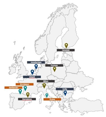
Antonio Rotundo (AgID, Italy) witnessed how the Re3gistry was successfully deployed in the INSPIRE Italia Registry, which now uses its v2.0. Antonio pointed out that the main benefits of the Re3gistry consist in harmonising and standardising recurrent codes in the vocabularies used for metadata, data sets and services, managing the persistent and unique identifiers of the elements used and linking the geospatial domain with eGov and general public sector domains.
T
- in the Policy and strategy focus area, for the definition of the Surveying and Mapping Authority strategy until 2025 and the digital transformation of the Ministry of the Environment and Spatial Planning;
- in the Digital government integration focus area, for the use of the SDI in the integration of spatial data into the spatial planning and building processes;
- in the standardisation and reuse focus area, with the adoption of ISO norms in the National standard for metadata.
How to go from here? Recommendations, possible next steps and future perspectives for location interoperability
Stakeholders involved in ELISE have expressed their expectations for the uptake of ELISE contributions in future interoperability activities. Future developments must take into account the key lessons learnt via ELISE: data access and sharing policies/tools are crucial for public bodies and policymakers to harness the full potential of location data; monitoring emerging location technology trends and location intelligence is essential for a healthy basis and development of data ecosystems; further guidance and monitoring of the progress made in advancing location interoperability governance are key; knowledge transfer support remains crucial to exploit location interoperability better and location enabled innovation assets across the policy landscape for all types of stakeholders.
Main outcomes from the final discussion
Javier Orozco Messana pointed out that using location information must be streamlined. On the policy level, the EU Interoperability Act will be the key political declaration for implementing the EU data spaces supporting the Digital Europe Programme (DEP). The exchange of data will be implemented through the corresponding architecture, and the Living in EU community promoted by DG CONNECT will take the lead in developing all these elements, relying on Minimal Interoperability Mechanisms (MIMs) for achieving interoperability of data, systems and services between cities and suppliers around the world. The INSPIRE Validator is one of the most important elements for data certification in the MIMs. Different calls in the Digital Europe Programme (DEP) are also meant to support solving all the challenges to the exploitation of interoperability in smart communities.
Tomaž Petek pointed out how the ultimate goal of “user-oriented” services cannot be achieved without interoperability. Providers of location data spaces cannot work in an isolated way. Without interoperability at all levels, from legal to semantic to technical, the use of location data and the user-centric approach could not be maximised. Capacity building and awareness raising are essential because it is necessary to show users the benefits of interoperability instead of waiting for them to recognise such benefits.
Gobe Hobona stressed that interoperability is a key part of how governments serve their communities. It helps governments support their country and their users efficiently and effectively and makes it possible to integrate different solutions that address the needs of different communities. Establishing standards is essential for this purpose, and OGC has worked in this direction, cooperating with the European Union. The INSPIRE Validator is one example of a standards-based solution that will continue supporting interoperability with other ELISE solutions.
Miguel Alvarez Rodriguez emphasised the significance of interoperability as a tool responding to organisations' need to connect and make the legislation more mature. Interoperability has been defined as the precondition to creating an integrated digital public services ecosystem. Lastly, the COVID-19 pandemic has shown the need for many domains and areas to push for full digitalisation beyond silos. The new legal act will ensure the governance of this approach to set up the foundation for bringing together different policies.
Francesco Pignatelli concluded that the conclusion of the ISA2 programme and ELISE is both an end and a beginning for continued cooperation with DIGIT, DG CONNECT (and in the future, DG REFORM) and national authorities to support the modernisation of public administrations. For this continuation, it will be necessary to focus on complementary objectives, such as supporting governance and implementing the Interoperable Europe act, the EIF evolution, the approach to digital policy making and the monitoring of interoperability state of play in Europe.
Slides and recording
Check out the recording and supporting slides of the session.
If you are interested in knowing more about ELISE Webinars you can find further information here