
Under ELISE action, the API4INSPIRE study, which has been investigating new developments in geospatial standards and technologies, foremost the new OGC API – Features and SensorThings API standards, is coming to the conclusion. In autumn 2020 a workshop was held explaining what is Dynamic Data, and why is it a valuable enrichment of an SDI. In this workshop the speakers will explain:
How to efficiently deal with complex spatial data sources and make them useful in your daily work?
Exposing complex spatial data via web services is a challenging and often painful task, requiring an in-depth understanding of both the source data models and the target schema. This task becomes increasingly difficult as different data users require different profiles of the data encompassed within one source, for the implementation of different use cases serving different communities. Together with experienced data providers, we have developed an alternative approach to exposing complex data sources as required to support a wide range of use cases with minimal configuration effort. A modular approach allows for a separation of concerns, reducing the effort required for each step.
Our approach consists of the following two functionalities, now available as GeoServers plugins for GeoServer:
- Smart Data Loader: In contrast to the existing GeoServer App Schema configuration, where in-depth knowledge of the target data model is essential for configuration, under Smart Data Loader the structure of the data to be exposed is dependent purely on the underlying data source; a schema is generated mimicking the native database structure, and the data exposed in accordance. During configuration, starting from an initial table, the user can interactively specify to which depth the associated data will be nested, pruning those aspects that need not be externalized. The output of this step is made available via OGC API - Features, to be further refined via Feature Templating.
- Feature Templating: Feature templating is where we align the output of the Smart Data Loader described above with the data models users are expecting. Here we’ve opted for a WYSIWYG approach, allowing the user to start with the final target, e.g., a simple JSON example, and then specify where the data content is to be taken from, e.g., an existing endpoint configured either via Smart Data Loader or also via the more traditional App Schema. With this templating approach, it becomes very simple to provide different profiles on one data source, each tailored to the needs of a specific community. At present templates can be specified in GeoJSON and JSON-LD; future work will extend this to XML (GML) and HTML.
In this webinar, Kathi Schleidt (INSPIRE Expert, co-chair of the OGC O&M SWG) from DataCove e.U. and Nuno Oliviera (Expert on OGC Services and their use within INSPIRE) from GeoSolutions, with support from Sylvain Grellet (INSPIRE Expert, co-chair of the OGC O&M SWG) from BRGM/ “INSIDE - environmental information systems research center" , will guide us through the steps described above based on real world examples progressing from simple to more complex use cases. The audience will see how we expose a data source in its native structure via Smart App Schema, then tailor it to specific usage areas and expose these via OGC API - Features.
Should you have any questions or interests concerning this topic, there will be an opportunity to participate in a Q&A session at the end of the webinar.
This webinar is a part of a series of “Webinars and events” performed by the European Commission's Joint Research Centre under the ELISE ISA² Action. The aim of these webinars is to quickly engage with new topics of relevance to the location interoperability, the digital transformation of government and socio-technical developments in this arena and to share the results and outcomes of ELISE action.
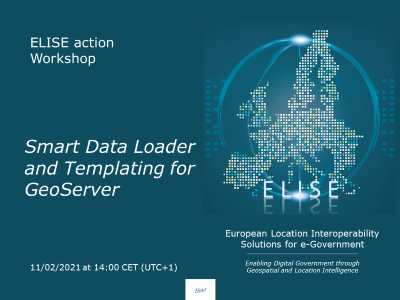
The webinar will take place on the 11/02/2021 at 14h00 CET (UTC+1).
If you are interested in this webinar, do not hesitate to register by clicking on the following button. You will receive a confirmation email with the instructions on how to join this webinar.

If you cannot join, register anyway, we will send you both the slides and the recording of the session.
After the webinar you will be able to find here both the recording and the supporting slides of this webinar.
If you are interested in knowing more about ELISE Webinars you can find further information here.
References
Details
14:00 - 14:05: Introduction
14:05 – 14:40: Overview OGC API – Features: What is the new standard?
- In this part, the audience will be introduced to the current status of the emerging OGC API - Features Standard. In addition, a basic overview of the Smart Data Loader and Feature Templating functionalities will be providing illustrating how these new technology link with existing data provision paradigms
[5 min break]
14:45 - 15:15: Smart Data Loader
- In this part, the Smart App Schema functionality will be explained and demonstrated on live datasets. We will start with a simple data source from the GO-PEG project in order to illustrate the basics of data provision under Smart Data Loader. We will then continue with a more complex example from INSPIRE in order to show how complex data can be made available and finally aligned with external schemas. Presentation will be followed by discussion.
[5 min break]
15:20- 15:50: Feature Templating
- Once we have exposed the data, we must tailor the output to the required profiles. In this section, the audience will learn how to utilize JSON templates in order to expose the same data source via different profiles in order to support different communities. Based on the endpoints configured in the previous section, we will demonstrate how to leverage the power of Feature Templating to expose this data via different profiles. GeoServer templating will be extended to XML and HTML encodings. Presentation will be followed by discussion.
15:50-16:00: Wrap-up